Award Holder: Tomos Llywelyn Evans
University: William & Mary, Williamsburg, Virginia
Title of Research: Community and Ontology in the Development of Africa’s Largest Monument: Understanding the Sungbo’s Eredo Earthwork System in Nigeria

Research Aims and Background
This field project funded by the Emslie Horniman Anthropological Scholarship Fund, administered by the RAI, addresses questions of chronology, labour, and long-term meaning pertaining to the landscape of Sungbo’s Eredo according to local ontologies. The Eredo constitutes a vast, 100-mile-long linear earthwork located in southwest Nigeria, thought to be Africa’s largest single monument (Darling, 1997; 1998s). It is a tremendous feat of engineering – a series of large banks and trenches that reach up to 20-metres in depth and which appear to encircle a specific area of territory that lies within the historical jurisdiction of the Ìjèbú Yorùbá kingdom, straddling Lagos and Ogun States, Nigeria.
Primary aim: To better understand when, how, and why was the monumental earthwork of Sungbo’s Eredo was constructed, used, and understood according to the indigenous worldviews of the Ìjèbú Yorùbá people.
Question 1 (“When?”): What is the chronology of the Eredo’s construction and later use, and how does this relate to broader socio-political developments occurring in West Africa at this time?
Question 2 (“How?”): How was local labour organised and mobilised in the construction of the Eredo, and in what ways were indigenous notions and structures of authority, competition, creativity, and composition both influential in, and shaped by, this process?
Question 3 (“Why?”): What was the nature and extent of the evolving, long-term, relationships between local settlements and the Eredo in its maintenance, meaning, and use?
These are, broadly, the “when?”, “how?”, and “why?” questions relating to Sungbo’s Eredo within its broader landscape. Question 1 is addressed using chronological evidence (from radiocarbon dates of charcoal samples and other artefacts acting as chronological indicators deriving from the earthwork and adjacent settlement sites). Question 2 is addressed through compilation of spatial data in a GIS as well as analysis of the earthwork’s stratigraphy. Question 3 relies on acquisition of material cultural and stratigraphic evidence from excavations at Augustine and Eredo Village, as well as from local knowledge of contemporary shrines and other sites of significance associated with Sungbo’s Eredo. It is this final question that was the most important for this fieldwork given the range of occupations observable in this landscape and the presence of shrines – often explicitly linked to the earthwork – at Eredo Village where research was undertaken.

Methods
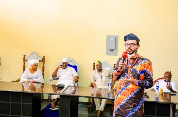
I worked with Nigerian team members of the Ife-Sungbo Archaeological Project to gather a field team of both experienced Nigerian PhD student collaborators from the University of Ibadan and local team members from Eredo Village. I was joined by Mr. Emmanuel Adeara and Mr. Nwosu Stanley Osinachi, PhD students from the University of Ibadan experienced in conducting archaeology in Nigeria, as well as Mr. Ayodokun Ola Olatunde a skilled fieldworker from Ibadan who has previously been involved in archaeological research. Mr. Adeara furthermore acted as an interpreter to better facilitate communication in Yorùbá, and also contributed additional photography to the project. We also recruited local community members led my Mr. Sadiq, son of the Baale (lineage head of Eredo Village). The total team was eight people. I conversed with Oba Olufolarin Olukayode Ogunsanwo, the Alara (king) of Ilara, the Baale (lineage head) of Eredo Village, and the staff of Augustine University at Ilara-Epe and secured their full continued support of this work. I also organised exhibitions to disseminate the research to the wider community of the region. For a fuller description of my field preparation, see my interim report for the RAI. A key difficulty that this report shall begin with is that of performing archaeological fieldwork during the COVID-19 pandemic, and the ways in which I adapted to that. As well as asking for masks to be worn during fieldwork, I opted to stick as much as possible with the same team of local community members who were recruited from the immediate area. This ensured that a “bubble” of sorts was maintained. Though my accommodation was at the nearby Augustine University, I limited close contact with the community there and always wore a mask when traversing. Given that I had a room to myself and that this was relatively isolated, the option of quarantining was available were I, or one of my PhD student collaborators, were to catch COVID.
Excavations were largely undertaken at Eredo Village following survey of the village and its surroundings. Eredo Village was selected as my research site due to its abundant archaeological deposits (visible as surface scatters and other landscape features), its close spatial and historical association with Sungbo’s Eredo – oral traditions suggest that it was an important Ìjèbú trading post and toll gate during the 19th century and likely earlier – and the number of contemporary shrines dedicated to various òrìsà (deities) and ancestors there that also appear to be closely linked to Sungbo’s Eredo. Early surveys are described in detail in my interim report, and pinpointed several areas of the village where we would focus excavations. Notably, I sought to excavate refuse deposits that would provide artefactual and chronological data useful in understanding evolving human practices in this area, and to provide material and chronological datasets for comparison with equivalent evidence from the earthwork itself (to be obtained from here during later work). These data are present in midden pit and refuse mound features, both of which are abundant in this landscape. Refuse accumulations are interesting, not only in that they yield artefactual data relevant to my research aims, but also in that they are influential material monuments in and of themselves which can shed light on the amalgamated meanings of this monumental landscape as populations developed them, accumulated them, and engaged with them over time. Frequently observed in close association with the earthwork, they may provide important evidence pertaining to the ways in which it continued to be interpreted by local village communities. Shrine visits were also conducted in November and January to document their locations, connections with the earthwork, and associated oral traditions and practices.
Excavations
We located two separate refuse mounds in the Eredo landscape which were selected for excavation. I term these ‘northern refuse mound’ and ‘southern refuse mound’ based on their relative positioning within the area we excavated. Both mounds were located adjacent to the earthwork itself (~100 metres northwest of the bank, on the “interior” side), and were within 20 metres of one another. Our survey made it abundantly clear that this landscape had been heavily modified by the expansion of Eredo Village – the northern refuse mound (which appeared to be over 40 metres in its diameter along a north-south axis) was bisected by a modern road, and furthermore, deposits had been removed and the ground levelled for the development of new households. The apex of the surviving area of this mound crossed between two separate modern house compounds separated by a wall, which meant that we required permission from both households to excavate.
We conversed with the household communities whose land we would be working on about our intended work. We explained my goals and aims to the owners of these areas of land, obtained permission to excavate, gave them supplies in return, and established where we would avoid excavating given the presence of recent burials and a contemporary shrine in this area. It is worth noting that it was a group of people from these compounds that pointed out the mound and its associated surface deposits to us during out survey and invited us to work on their land, and thus local consultation was important here in locating the site in the first place. The community collaborators were important here given their familial (and other) connections with local people throughout Eredo Village, and this ensured that our work progressed smoothly and remained in the interests of the community. The Eredo has been a convenient source of additional income for the community with Mr. Sadiq and others regularly touring Nigerian visitors around the earthwork, in return for payment. As such, archaeological work here tends to be viewed as a source of additional recognition that has the potential to stimulate more tourism in the future.
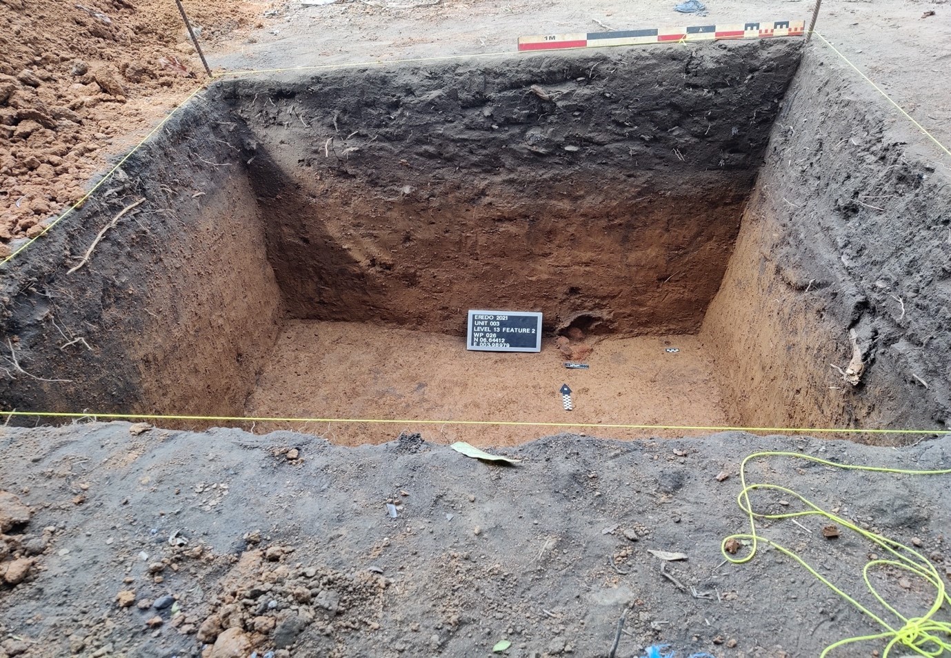
Northern refuse mound excavation: the first two layers of this mound consisted of dark, humic, refuse. As well as hundreds of ceramics, these deposits yielded 20th century manufactured objects (such as a modern door handle), large amounts of scrap metal and large iron sheets from containers (potentially linked with an Ogun (the deity of iron) shrine just a few feet to the east), slag (demonstrating local smelting), abundant charcoal deposits, two coins (a Naira coin from 1973 and a silver British threepence from 1897 respectively), glass (primarily from cuboidal gin and schnapps bottles), European manufactured wares, African giant snail (Lissachatina fulica) shell, cowrie shells, a fragment of turtle carapace, plastic, medium and large mammal bones and teeth (likely largely Bovid and ovicaprid), burnt clay (construction debris), and charred palm kernel. Notably, 20th century finds (such as plastic, certain manufactured goods, and the 1973 coin) occurred only in the very uppermost levels, whereas other finds only began appearing once we dug deeper (such as slag from level 4 downwards as well as the 1897 coin). Below these probable refuse layers was a distinctly different layer – brown, fine, and more compact, and seemingly representing architectural refuse, most likely that of a collapsed earthen structure. Artefacts abundant in the refuse layers above such as European manufactured wares, glass, and faunal material were not present here. Novel finds included grindstones, large rocks (unmodified but deliberately associated with artefactual features), and, near the base of the deposit, tiny low-fired or terracotta complete pots, apparently in-situ and associated with an accumulation of stone, ceramics (plain and undecorated unlike ceramics in the upper refuse layers) and burnt clay building material – a possible shrine predating the above refuse dump. The gradually changing composition of finds in the upper layers (including the numismatic evidence), coupled with the sudden break in the matrix and content of the layer below, led me to hypothesise that the entire mound was not the result of a relatively discrete period of dumping, but likely the product of a longer-term process of refuse accumulation that perhaps incorporated several generations and/or periods of occupation, with an eventual shift from more local iron production and use of cowries (as both currency and adornment) to increased dependency on imported metal objects and coins later. The later refuse was placed on top of a pre-existing architectural mound containing a potentially sacred feature, thus suggesting long-term development of monumental features in this area, exemplifying the identity of differential communities and rooting and connecting them with ancestral features in the Eredo landscape.
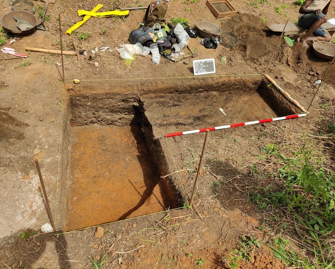
Southern refuse mound excavation: Interestingly, our excavations of Units 5 and 6 yielded significantly different results from those of Units 3 and 4, exhibiting that, not only might refuse mounds in this area display clear stratigraphic differences within them, there’s also considerable diversity between them. The deposit here was lighter: a dark reddish brown colour (Munsell: 5 YR 3/4), but was similarly loose, and artefactual finds indicated domestic refuse dumping rather than architectural debris. Unit 5 yielded similar local ceramics, European ceramic, metal, glass, and bone finds to the northern refuse mound, as well as manufactured beads (the only ones found throughout the excavation – likely recent in date). As the excavation progressed, we uncovered small glass jars (likely medicinal) and continued finding similar artefacts to those found in the first level. Charred palm kernel, charcoal, and Bovid and ovicaprid bone and teeth became more abundant by levels 3 and 4, and at ~35cm deep, we found a complete imported wine bottle. Near complete snail shells were abundant, but cowries were notably absent. The deposit became darker as we reached level 5 and beyond. Unit 6, nearer the base of the mound, revealed a shrine to the threshold òrìsà Eshu (with an associated in-situ complete pot) as well as a refuse pit. Abiding by the wishes of our local collaborators, the pot was given to the Eredo Village community and the shrine was left in-situ, but excavation of the pit feature nearby was permitted. Of particular note here was the abundance of ceramics, as well as faunal remains – large, near complete cattle and ovicaprid bones, as well as potentially other species. Whether this pit represents and older accumulation of refuse, or something more recent (perhaps associated with offerings made to the Eshu shrine) remains uncertain – charcoal samples were collected for radiocarbon dating which will shed more light on this.

Other excavations: lastly, we excavated a midden pit close to the Eredo (Unit 8) which yielded a range of domestic refuse including hundreds of local ceramic sherds, European ceramics, complete land snail shells, mammal bones and teeth of various kinds, glass bottle finds, a fragment of pipe stem, charred palm kernel, cowrie shells, and scrap metal. The stratigraphy was more complex than that seen at the refuse mounds with interchanging accumulations of ashy deposits and other refuse deposits. Given the unusual stratigraphy and abundance of artefacts, a further 2x1 metre extension was added to this to further understand this feature. Posnansky’s (2013) ethnoarchaeological work at Hani (Ghana) notes that it is common for old borrow pits (for architectural maintenance), situated between houses, to be used for refuse deposition, with young girls sweeping interior compounds and around the houses using grass whisks. These sweepings are then deposited in these pits, and they include ashy hearth deposits, vegetable refuse (e.g. peelings from yams, potatoes, and other tubers), animal bones from stews, and other ordinary household rubbish. This is what the Unit 8 midden appears to represent given the content of it, and its positioning between the probable ruins of old compound structures. I obtained charcoal samples for radiocarbon dating from this midden pit. Based on the similarity of material throughout, I believe it likely that these deposits derive from multiple episodes of deposition over a short period of time (as such pits are known to fill quickly), perhaps during the 18th and/or 19th centuries. The wealth of material present here and in the refuse mounds, including large mammal bones, items pertaining to international trade, and complete cowrie and snail shells, suggests that the Eredo Village community at this time was likely prosperous and closely connected with regional and international trade – an interpretation which is supported the oral traditional evidence from here.

Shrine Visits
The Interim Report gives more background on the shrine visits (conducted early in our fieldwork). The shrine sites – to the òrìsà Gborowo, Ogun, Eshu, Obaluaye, and Awuren – are significant in that they reveal a historic path through the earthwork associated with Eredo Village’s original role (recalled in oral tradition) as a toll gate and place of trade. The shrines, especially those associated with deities of thresholds (Ogun, Eshu, Obaluaye) and disease and health (Obaluaye) are significant in that they reveal that the Eredo was an important political-spiritual boundary that perhaps helped regulate incoming people and spirits and the (potentially dark, destructive and chaotic) forces that accompanied them. The shrines historically may have acted as means of cleansing incomers by trapping and dispelling some of the more negative influences that they brought in (Warnier, 2007; Chouin, 2022). These observations all reveal that Sungbo’s Eredo remained important to the life of this community right up to modern times, likely in a repeatedly re-interpreted manner associated more with the area’s connection with trade during the later periods of its use. Lastly, I observed the remains of a recently destroyed site that had once been home to a sacred silk-cotton tree (Ceiba pentandra) that is thought to have housed several rooms occupied by spirits. Patrick Darling (1997, 1998) observed silk-cotton trees at regular intervals along the earthwork which may have been significant at various periods of the earthwork’s use – as parts of old fortifications, watchtowers, and lookout points (Basu, 2008) as well as the homes of protective spirits that further served in regulating thresholds (Agbaje-Williams, 2005; Gurstelle, 2013).

Contributions to Anthropology
The combination of artefactual and ethnographic evidence obtained pertaining to monumental mounds, midden deposits, and shrines will contribute to a growing body of scholarship aimed at better understanding the chronology, construction, functions, and meanings of Sungbo’s Eredo. While previous studies of West African earthworks have tended to interpret them according to more utilitarian functions (such as often narrow and ethnocentric conceptions of defence and physical control) and have typically focused only on their “original” period(s) of construction and use, this research has moved beyond this to consider the ways in which the earthwork was constructed and used, as well as how it has continued to be used, from a perspective rooted more in Yorùbá concepts pertaining to thresholds (and their regulation), monumentality, and social organisation and functioning. In this regard, my work is seeking to be multidisciplinary in looking to better connect archaeological research with the invaluable findings of social anthropological, art historical, and historical work, much of which has been focussed on developing our knowledge of Yorùbá ontologies past and present. In terms of methods, my work has also been rooted in community collaboration where research design, dissemination, and research outcomes has been conducted via close consultation with local communities as well as with academic archaeologists from Nigeria. In both examples, the work seeks to contribute to a growing number of studies seeking to decolonise archaeology and anthropology in Africa (Lane, 2011; Harrison, 2011; Schmidt and Pikirayi, 2016) which centre African people, worldviews, needs, and aspirations in research to ensure that such work speaks to and benefits African populations.